Jumat, 21 Mei 2010

SAMARINDA CITY TOURISM, EAST KALIMANTAN - INDONESIA

Samarinda City is a city which once also the capital of East Kalimantan province, Indonesia. Directly adjacent to the Regency. Samarinda City can be achieved with a trip by land, sea and air. With the Mahakam River which divides in the middle of the city of Samarinda, the "gateway" into the interior of East Kalimantan. The city has a total area of 718 km ² and a population of 770 753 inhabitants.

With an area of 718 km ², Samarinda is located in the equatorial region with coordinates between 0 ° 21'18 "-1 ° 09'16" latitude and 116 ° 15'16 "-117 ° 24'16" longitude.


Samarinda City Tourism Places
:

Cultural Tourism Zone Pampang
Pampang area located about 20 km from the town of Samarinda is an attractive cultural tourism area to witness the life of Dayak Kenyah tribe. This cultural tourism object can be reached by use of motor vehicles through the streets of Samarinda-Bontang. The attraction can be witnessed is Lamin or traditional house of Dayak tribes and the dances and ceremonies of the indigenous Dayak Kenyah.


Waterfall Tanah Merah
Located about 14 km from downtown Samarinda Purwosari precisely in the hamlet of North Samarinda district. It is the right choice for family tourism as a rest pavilion equipped, shelter with shade trees around the site, stalls, large vehicle parking area, an open stage and bathhouse. to achieve these attractions can be reached by motor vehicle either two or four wheels as well as public transportation routes Segiri Market - Siring River. . Despite the many places of tourist attraction, the waterfall at the Tanah Merah North Samarinda was still provide its own nuances. No wonder if there are many visitors who arrive each day to see the condition of natural waterfalls in Samarinda. With the cost of levy of 1 US/people, you have to enjoy this tourist attraction along the path that led Kea red waterfall.


Captive Crocodile Makroman
Top Island is located in the village, district Palaran with distance approximately 6 km from Samarinda. Species of crocodiles that are kept are freshwater crocodiles and alligators Supit. This crocodile breeding places have been in complete tourist facilities and infrastructure.

Botanic Garden Samarinda
Located in the northern city of Samarinda, a distance of 20 km or 30 minute trip inland. At the Botanical Garden there are attractions Samarinda natural lake, zoo, entertainment stage.

Telaga Batu Permai Besaung
Telaga Batu Permai Object Besaung tourism is nature tourism, is located in Sempaja 15 km from downtown Samarinda with motor vehicle / car. This tourist attraction has been equipped with tourist facilities and infrastructure.


Ikat Weaving Crafts Samarinda Sarong
Located on the road Bung Tomo Samarinda Seberang. This tourist attraction is the traditional glove-making process of Samarinda, which is 8 km from downtown Samarinda. Object has been dilengakapi tourism facilities and infrastructure. Kerajian woven sarongs initially brought by settlers Bugis from Sulawesi who resided at the left side of the Mahakam (now a Samarinda Seberang). Almost every Bugis Village (village mosque Baka) can be found craftsman Samarinda sarongs. The loom used by the craftsmen is a traditional instrument called "Gedokan" or using Non Woven Machine Tool (ATBM). Products produced for the first (one) sarong took three weeks.

Green Valley Recreation Park
Green Valley tourism object is a natural attractions, is located on the traffic Samarinda - Bontang 15.5 km from Samarinda by vehicle / motorcycle. Atrakasi contained object that is adjacent to the fence of this nature is to display replica attraction is the forest of Borneo forest timber species and rattan plants contained in these tourist sites. The facilities available are: cafeteria, meeting hall and fishing ponds, camping ground.


Forest Unmul
Located 3 km from the terminal Lempake equipped sports facilities, boat tours, a mini zoo. For tourists who will visit the natural attractions of Forest Kingdom Unmul can use four-wheeled vehicles although there are available personnel and information centers ..
One of the privileges in this botanical garden is the existence of a vast zoo. At the zoo there are a number of orangutans that have been deliberately released yet been tamed so that visitors can directly interact. In addition to the orangutans also have other animals, such as a pair of cobra snakes, hornbills, parrots, ponies, birds of paradise, crocodiles, deer, and porcupine. It's just the end of the need to climb stairs high hill. However, this condition seems to have become an attraction for visitors from various regions, including from outside the East.

Visitors can also enjoy a vast artificial lake. In these attractions, visitors can hire a boat with a wide range of forms. The rent is Rp. 15000.00 per 15 minutes with a limit of three adult content.

Admission price is USD. 3000.00, both for adults and also children. This price is inclusive for vehicles coming into the area botanical garden.


Banks of the Mahakam River (Mahakam River Tours)
Mahakam River is a river which surrounds most of the regency, West Kutai, and Samarinda.
Social and Cultural Activities masyaraakt Samarinda could be witnessed, such as: utilization of the river as a means of transportation to transport passengers and goods, and agricultural products traded between the island and exported to mancabegara through the port of Samarinda. Utilization of the river to support the everyday social life as fishermen, traders, housewives, traditional shipbuilders, and others.
When the night can also be witnessed and enjoyed roasted corn, and a few other food stalls along the waterfront edge of this Mahakam.


Mahakam River


Mahakam Bridge

Kamis, 20 Mei 2010

HISTORY OF SAMARINDA CITY (EAST KALIMANTAN)

The origin of the founding SAMARINDA CITY
At the outbreak of war Gowa, Dutch forces under Admiral Speelman VOC led naval attacks from the sea of Makassar, while Sporting Palakka that receive aid from the Netherlands because he wanted to release the Bone from colonialism Sultan Hasanuddin (Gowa king) attacked from the mainland. Finally able to defeat the kingdom of Gowa and Sultan Hasanuddin was forced to sign an agreement known as Bungaya Agreement on November 18, 1667.

Some Wajo Bugis people of the kingdom of Gowa who would not submit and adhere to the agreement Bongaja, they still continue the struggle and the guerrilla insurgency against the Dutch and others fled to other islands of which there is a move to the area of Kutai Sultanate, namely the group led by Lamohang Mangkona Daeng (titled Pua Ado first). Arrival Wajo Bugis people of the Kingdom of Gowa was well received by the Sultan of Kutai.

Consent and agreement, by the King of Kutai entourage was given location around the village take the floor, a good low-lying areas to the business of Agriculture, Fisheries and Trade. In accordance with the agreement that the Bugis people of all interests Wajo must help the King of Kutai, especially in facing the enemy.

All of these groups chose the area around the estuary of the Coral Mumus (Selili regions across) but raises difficulties in this area because the areas that have current voyage round (berulak) with lots of dirt river. In addition to the background of the mountains (Mount Selili).

Samarinda Seberang
History of the opening of a village that became a big city, quoted from the Dutch-language book titled "Geschiedenis van Indonesie" bouquet de Graaf. NV.Uitg.WVHoeve book published, The Hague, in 1949 also talked of starting with the opening of Samarinda City township in Samarinda Seberang Poea led by Adi. Dutch binding agreement with the sultanate of Kutai more and more growth. In fact, gradually mastering the Dutch economy in this area. To develop trade activities, then the Dutch colony in Samarinda Seberang opened in 1730 or 62 years after Poea Adi build Samarinda Seberang. That's where the focus of Dutch trade. However, the development of Samarinda Seberang by the Netherlands also with the permission of the Sultan of Kutai, given the economic and defense interests of the community in the area. Moreover, the Dutch at that time also put the troops for war in this region so it ensures security for Kutaisi.

Samarinda continued to grow with the aging population who come from Java and Sulawesi in the past waku hundreds of years. Even up to the peak of independence in 1945 until the collapse of the Old Order is replaced by the New Order, Samarinda continued 'disatroni' migrants from outside Kalimantan. It was the Year 1966 is a transitional period of the Old Order to New Order. Circumstances it is still random and semberawut. Security problems of the people was assured by the formation of Civil Defence (Civil Defence), which replaces the OPR (People's Defense Organization). Defence supports the presence of police and army.

Although spelled forward in his day, significant changes began when the Mayor of Samarinda Kadrie Oening appointed and determined by the Minister of the Interior with No.Pemda Decree 7 / 67/14-239 dated November 8, 1967. He replaced Maj. Ngoedio who later served as high officials of government in Surabaya of East Java. Samarinda Municipality in 1950 is divided into three districts, namely Samarinda Ulu Subdistrict, Samarinda Ilir and Samarinda Seberang. The total area was only 167 km ². Then in 1960 the area was expanded to Samarinda 2727 sq km area including Palaran District, Sanga-Sanga, Java and Samboja Estuary. But lately, again there is a change. Only district of Samarinda City Exploration Overseas, Samarinda Ilir, and Samarinda Ulu.

Determination of the anniversary of SAMARINDA CITY
Wajo Bugis people are living in Samarinda at the beginning of the year 1668 or precisely in January 1668 that as a benchmark to determine the anniversary of the city of Samarinda. Local regulations have been set at the Municipal City of Samarinda Number: 1 of 1988 dated January 21, 1988, article 1 reads Day Samarinda decided on January 21, 1668 AD, coincided with the date of determination 5 Sha'ban 1078 H was conducted to coincide with the commemoration anniversary of the city of Samarinda to 320 on January 21, 1980. 21 Januari 1668 / 5 Ramadhan 1070 H: Arrival Bugis Wajo people establish a settlement at the mouth of Karang Mumus.

The establishment of the City Government of Samarinda
Formed and established on January 21, 1960, according to Emergency Law No. 3 In 1953, Official Gazette No. 97 Year 1953 on the Establishment of the regions Level II Districts / municipalities in East Kalimantan

Dati II Samarinda Municipality originally divided into three districts, namely Samarinda Ulu Subdistrict, Samarinda Ilir, and Samarinda Seberang. Then with the SK Provincial Governor of East Kalimantan Province No. I. 18/SK/TH-Pem/1969 and Decree No. 55/TH-Pem/SK/1969, starting on March 1, 1969, an administrative region Dati II Samarinda Municipality plus the four districts, namely Palaran District, Sanga-Sanga, Java and Samboja Estuary. Samarinda currently consists of six districts, not including the Sanga-Sanga, Java Muara and Samboja, all three signed the regency.

After PP No. 38 Years published in 1996, the administrative area of Dati II Samarinda Municipality experienced expansion, originally consisted of four districts into six districts, namely:
  • District of Samarinda Ilir with 13 wards,
  • District of North Samarinda with six villages,
  • District of Samarinda Ulu with eight villages,
  • District of Samarinda Seberang with eight villages
  • Kunjang River District with seven villages, and
  • District Palaran with five wards.
Subdistrict and village plans will be separated again with the proposed name of Samarinda City district, Southern district of Samarinda, sub-Speech, and Sungai Pinang subdistrict. These proposals are still under discussion Parliament Samarinda.

Under Regulation No. Samarinda. 1 Year 1988, dated January 21, 1988, Samarinda Anniversary set is dated January 21, 1668. This determination coincides with Memorial Day to Be Samarinda-320.

That's the HISTORY OF THE SAMARINDA CITY an Integral part Of EAST KALIMANTAN PROVINCE. May be useful for you. Thanks

Rabu, 19 Mei 2010

EAST KALIMANTAN PROVINCE TOURISM, BORNEO INDONESIA

East Kalimantan Province is one part of Borneo. Borneo alone has an area of 750 000 km covered in the three countries, is the world's third largest island after Greenland and New Guinea. In northern Borneo, including the country of Malaysia (Sabah and Sarawak), on the west coast of the Sultanate of Brunei Darussalam. While the largest part of Borneo, a territory of Indonesia is divided into four provinces, namely West Kalimantan, South Kalimantan, Central Kalimantan and East Kalimantan.

East Kalimantan capital of Samarinda, the extent of 211 440 km2 (about 28% area of Borneo), located between 1130 44 '- 1190 00' east longitude and 40 24 'north latitude and 20 25' latitude south, with borders to the north with the state of Sabah (East Malaysia), while on the west side of Central Kalimantan, West Kalimantan and Sarawak (East Malaysia). On the east by the Makassar Strait and Sulawesi Sea, while in the south with the South.

Administratively, the province of East Kalimantan is divided in four cities (Samarinda, Balikpapan, Tarakan, and Bontang), 10th District (Bulungan, Pasir, Berau, West Kutai, East Kutai, Kutai Kertanegara, Malinau, Nunukan, Penajam North Paser, and Tana Tidung ).

The Residents Of East Kalimantan
The native of East Kalimantan and the Dayak tribes are Malays (Kutai, Tidung), the majority of them living in rural and border areas. Population growth in East Kalimantan, characterized by a predominantly ethnic structure of migrants, so the natives a minority.

The entry of newcomers make the population growth in East Kalimantan, including one of the highest in Indonesia, which is about 5.8% per year. That is because the arrival of migrants from outside the province as a result of the "boom" in oil and forest exploitation. According to 1996 statistics, the population reached 2,599,165 people in
East Kalimantan. Groups of migrants who entered East Kalimantan, most originating from East Java (35%), and South Sulawesi (25.2%), South Kalimantan (11.8%) and Central Java (11.9%). In addition there are still migrant in small quantities from the East Nusa Tenggara, Bali, Maluku and North Sumatra.

Rivers And Lakes In East Kalimantan
In East Kalimantan, there are 161 rivers with overall length of approximately 347 937 km, tipped in the highlands and mountainous regions along the border of Central and South Kalimantan and East Malaysia towards the coastal areas in the Makassar Strait and Sulawesi Sea.

River is vital to society, other than as a source of well water for transportation. Most can be navigable rivers and rivers of which there are eight major cruise lines that are important, namely the Mahakam (920km); Kayan (576km); Sesayap (278 km); Sembakung (278 km); Segah (162 km); Belayan (319 km ); Kendilo (191 km); Kelay (254 km) and Berau (292 km).

In low-lying areas along these streams, there are 104 lakes with total area reached 106 057 hectares. Three of them are the largest and most important to the habitat of Irrawaddy Dolphin fish (freshwater dolphins) there is in Kutai, namely Jempang lake (15,000 ha); Semayang (13 000 ha) and Across (11 000 ha).


Natural Resources
East Kalimantan Province is one of the richest provinces in Indonesia, and forests are a potential natural resources in the province. The area of forest in East Kalimantan reached 21 155 million hectares. Based on Forest Land Use Agreement, the allotment is as follows: Forest Nature Reserve (1.9686 million ha); Protected Forest (3.6263 million ha); Limited Production Forest (4.8261 million ha); Forest Production Equipment (5.51306 million ha); Conversion Forest (5.19238 million ha); Others (17 500 ha). In addition to the forest, there are many natural resources owned by East Kalimantan province, including oil and natural gas, coal, gold, nickel, and sand. Another sector that is now being developed are agriculture, tourism, and manufacturing industries.

Some regions such as Balikpapan and Bontang began developing industrial estates every sector to accelerate economic growth.


Arts and Culture

1. Vernacular
The languages of East Kalimantan region included in the Austronesian language of Malayo-Polynesian family. Among them: Language Tidung, Banjar Language, Language Berau and Kutai language. What language is the language Lundayeh Other.


2. Traditional Weapons
  • Mandau - ManaauGayang
  • Chopsticks - Potaan
  • Shield - Keleubet
  • Spear - Belolokng
EAST KALIMANTAN PROVINCE Tourism

East Kalimantan has several interesting tourist destinations such as Derawan in Berau islands, the Kayan Mentarang National Park and Batu Lamampu Beach in Nunukan, Manggar crocodile farm and the beach at Balikpapan, deer farms and Tanjung Jumlai in Penajam, Dayak Pampang Village in Samarinda,
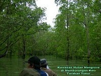
Mangrove forest and Amal Beach Tarakan City, Kumala Island in Tenggarong, and others. In east Kalimantan approximately 1000-189.000 plant species growing around such a black orchid price per flower can reach 100000-500000 But there are obstacles in the heading above places namely transportation. Many parts in this province still do not have asphalt roads, so many people travel by boat and aircraft and would not be surprised if in East Kalimantan has a lot of pioneering airports. In addition, there will be making plans Balikpapan-Samarinda Highway-Bontang-Sangata to accelerate the economy.

Derawan Island

Batu Lamampu Beach

Manggar Beach

Tanjung Jumlai Beach

Dayak Pampang Village

Mangrove Forest

Bekantan In Mangrove Forest

Amal Beach

Kumala Island