Rabu, 09 Juni 2010

Tarakan City - East Kalimantan Province

Tarakan is the island in East Kalimantan Province, Indonesia. This marshy island situated in the Celebes Sea, off the northeast coast of Borneo. This island has an area of 657.33 km ². Tarakan city located on the island. Tidung tribes were the original inhabitants of the island of Tarakan. Tarakan is where the battle between Allied and Japanese in the Battle of Tarakan in 1942 and 1945.

History Of Tarakan City
Tarakan according to folklore comes from the Tidung continence (met) and Ngakan (eat), which literally means "Place of the fishermen for lunch, to meet and make exchanges with other fishermen haul. In addition Tarakan is also a meeting place Kayan River estuary flows, Sesayap and Malinau. Formerly on the island of Tarakan never stood a kingdom as the Kingdom of Tarakan (Tidung), Central government, which first was Binalatung area and continue to move up to the area Pamusian.

In the days of Dutch colonialism
Peace of the local community rather annoyed when in 1896, a Dutch oil company, BPM (Bataavishe Petroleum Maatchapij) discovered the existence of oil resources in the island. Many workers were imported mainly from Java island, with the increase in drilling activity. Considering the function and development of this region, in 1923 the development of this region, in 1923 the Dutch government felt it necessary to put an assistant resident on the island who supervises five (five) regions namely; Cape Selor, Tarakan, Malinau, Apau Kayan and Berau .


But in the post independence, the Government of Indonesia felt the need to change the status of Tarakan to Tarakan District in accordance with presidential decree No.22 of 1963.

At the time of Independence
The location and strategic position has been able to make the district as one of the centers of Tarakan in East Kalimantan Industry northern part so that the Government needs to raise its status to the City Administrative accordance with Government Regulation No.47 Year 1981.

Administrative City status again upgraded to municipality under Republic Act No.29 of 1997 which was inaugurated done directly by the Ministry of Home Affairs on December 15, 1997, marked the anniversary date as the Tarakan City.

Tarakan City is the one of the city in East Kalimantan province, Indonesia. This city has an area of 657.33 km ² and in accordance with the Civil Data Department of Population and Family Planning Tarakan City in March 2006 has a population of 178 111 inhabitants. Tarakan or also known as the Earth Paguntaka is an island located in the northern East Kalimantan Province.

City Government of Tarakan
Today, Tarakan City led by Mayor H. Udin Hianggio. Tarakan city is divided into four sub-district (west of Tarakan, Tarakan east, middle Tarakan, Tarakan north) and 20 villages.

With the slogan of BAIS (Clean, Safe, Beautiful, and Welfare) Tarakan City was transformed into one of the cleanest cities in Indonesia.

Many charter awards from both domestic and overseas who successfully achieved all of Tarakan City you can see the Tarakan City official website HERE.

Office of the City Government of Tarakan


Tarakan City Beach

You want to visit the Tarakan City? Want to know Tarakan Tourism? Please Visit HERE

Jumat, 21 Mei 2010

SAMARINDA CITY TOURISM, EAST KALIMANTAN - INDONESIA

Samarinda City is a city which once also the capital of East Kalimantan province, Indonesia. Directly adjacent to the Regency. Samarinda City can be achieved with a trip by land, sea and air. With the Mahakam River which divides in the middle of the city of Samarinda, the "gateway" into the interior of East Kalimantan. The city has a total area of 718 km ² and a population of 770 753 inhabitants.

With an area of 718 km ², Samarinda is located in the equatorial region with coordinates between 0 ° 21'18 "-1 ° 09'16" latitude and 116 ° 15'16 "-117 ° 24'16" longitude.


Samarinda City Tourism Places
:

Cultural Tourism Zone Pampang
Pampang area located about 20 km from the town of Samarinda is an attractive cultural tourism area to witness the life of Dayak Kenyah tribe. This cultural tourism object can be reached by use of motor vehicles through the streets of Samarinda-Bontang. The attraction can be witnessed is Lamin or traditional house of Dayak tribes and the dances and ceremonies of the indigenous Dayak Kenyah.


Waterfall Tanah Merah
Located about 14 km from downtown Samarinda Purwosari precisely in the hamlet of North Samarinda district. It is the right choice for family tourism as a rest pavilion equipped, shelter with shade trees around the site, stalls, large vehicle parking area, an open stage and bathhouse. to achieve these attractions can be reached by motor vehicle either two or four wheels as well as public transportation routes Segiri Market - Siring River. . Despite the many places of tourist attraction, the waterfall at the Tanah Merah North Samarinda was still provide its own nuances. No wonder if there are many visitors who arrive each day to see the condition of natural waterfalls in Samarinda. With the cost of levy of 1 US/people, you have to enjoy this tourist attraction along the path that led Kea red waterfall.


Captive Crocodile Makroman
Top Island is located in the village, district Palaran with distance approximately 6 km from Samarinda. Species of crocodiles that are kept are freshwater crocodiles and alligators Supit. This crocodile breeding places have been in complete tourist facilities and infrastructure.

Botanic Garden Samarinda
Located in the northern city of Samarinda, a distance of 20 km or 30 minute trip inland. At the Botanical Garden there are attractions Samarinda natural lake, zoo, entertainment stage.

Telaga Batu Permai Besaung
Telaga Batu Permai Object Besaung tourism is nature tourism, is located in Sempaja 15 km from downtown Samarinda with motor vehicle / car. This tourist attraction has been equipped with tourist facilities and infrastructure.


Ikat Weaving Crafts Samarinda Sarong
Located on the road Bung Tomo Samarinda Seberang. This tourist attraction is the traditional glove-making process of Samarinda, which is 8 km from downtown Samarinda. Object has been dilengakapi tourism facilities and infrastructure. Kerajian woven sarongs initially brought by settlers Bugis from Sulawesi who resided at the left side of the Mahakam (now a Samarinda Seberang). Almost every Bugis Village (village mosque Baka) can be found craftsman Samarinda sarongs. The loom used by the craftsmen is a traditional instrument called "Gedokan" or using Non Woven Machine Tool (ATBM). Products produced for the first (one) sarong took three weeks.

Green Valley Recreation Park
Green Valley tourism object is a natural attractions, is located on the traffic Samarinda - Bontang 15.5 km from Samarinda by vehicle / motorcycle. Atrakasi contained object that is adjacent to the fence of this nature is to display replica attraction is the forest of Borneo forest timber species and rattan plants contained in these tourist sites. The facilities available are: cafeteria, meeting hall and fishing ponds, camping ground.


Forest Unmul
Located 3 km from the terminal Lempake equipped sports facilities, boat tours, a mini zoo. For tourists who will visit the natural attractions of Forest Kingdom Unmul can use four-wheeled vehicles although there are available personnel and information centers ..
One of the privileges in this botanical garden is the existence of a vast zoo. At the zoo there are a number of orangutans that have been deliberately released yet been tamed so that visitors can directly interact. In addition to the orangutans also have other animals, such as a pair of cobra snakes, hornbills, parrots, ponies, birds of paradise, crocodiles, deer, and porcupine. It's just the end of the need to climb stairs high hill. However, this condition seems to have become an attraction for visitors from various regions, including from outside the East.

Visitors can also enjoy a vast artificial lake. In these attractions, visitors can hire a boat with a wide range of forms. The rent is Rp. 15000.00 per 15 minutes with a limit of three adult content.

Admission price is USD. 3000.00, both for adults and also children. This price is inclusive for vehicles coming into the area botanical garden.


Banks of the Mahakam River (Mahakam River Tours)
Mahakam River is a river which surrounds most of the regency, West Kutai, and Samarinda.
Social and Cultural Activities masyaraakt Samarinda could be witnessed, such as: utilization of the river as a means of transportation to transport passengers and goods, and agricultural products traded between the island and exported to mancabegara through the port of Samarinda. Utilization of the river to support the everyday social life as fishermen, traders, housewives, traditional shipbuilders, and others.
When the night can also be witnessed and enjoyed roasted corn, and a few other food stalls along the waterfront edge of this Mahakam.


Mahakam River


Mahakam Bridge

Kamis, 20 Mei 2010

HISTORY OF SAMARINDA CITY (EAST KALIMANTAN)

The origin of the founding SAMARINDA CITY
At the outbreak of war Gowa, Dutch forces under Admiral Speelman VOC led naval attacks from the sea of Makassar, while Sporting Palakka that receive aid from the Netherlands because he wanted to release the Bone from colonialism Sultan Hasanuddin (Gowa king) attacked from the mainland. Finally able to defeat the kingdom of Gowa and Sultan Hasanuddin was forced to sign an agreement known as Bungaya Agreement on November 18, 1667.

Some Wajo Bugis people of the kingdom of Gowa who would not submit and adhere to the agreement Bongaja, they still continue the struggle and the guerrilla insurgency against the Dutch and others fled to other islands of which there is a move to the area of Kutai Sultanate, namely the group led by Lamohang Mangkona Daeng (titled Pua Ado first). Arrival Wajo Bugis people of the Kingdom of Gowa was well received by the Sultan of Kutai.

Consent and agreement, by the King of Kutai entourage was given location around the village take the floor, a good low-lying areas to the business of Agriculture, Fisheries and Trade. In accordance with the agreement that the Bugis people of all interests Wajo must help the King of Kutai, especially in facing the enemy.

All of these groups chose the area around the estuary of the Coral Mumus (Selili regions across) but raises difficulties in this area because the areas that have current voyage round (berulak) with lots of dirt river. In addition to the background of the mountains (Mount Selili).

Samarinda Seberang
History of the opening of a village that became a big city, quoted from the Dutch-language book titled "Geschiedenis van Indonesie" bouquet de Graaf. NV.Uitg.WVHoeve book published, The Hague, in 1949 also talked of starting with the opening of Samarinda City township in Samarinda Seberang Poea led by Adi. Dutch binding agreement with the sultanate of Kutai more and more growth. In fact, gradually mastering the Dutch economy in this area. To develop trade activities, then the Dutch colony in Samarinda Seberang opened in 1730 or 62 years after Poea Adi build Samarinda Seberang. That's where the focus of Dutch trade. However, the development of Samarinda Seberang by the Netherlands also with the permission of the Sultan of Kutai, given the economic and defense interests of the community in the area. Moreover, the Dutch at that time also put the troops for war in this region so it ensures security for Kutaisi.

Samarinda continued to grow with the aging population who come from Java and Sulawesi in the past waku hundreds of years. Even up to the peak of independence in 1945 until the collapse of the Old Order is replaced by the New Order, Samarinda continued 'disatroni' migrants from outside Kalimantan. It was the Year 1966 is a transitional period of the Old Order to New Order. Circumstances it is still random and semberawut. Security problems of the people was assured by the formation of Civil Defence (Civil Defence), which replaces the OPR (People's Defense Organization). Defence supports the presence of police and army.

Although spelled forward in his day, significant changes began when the Mayor of Samarinda Kadrie Oening appointed and determined by the Minister of the Interior with No.Pemda Decree 7 / 67/14-239 dated November 8, 1967. He replaced Maj. Ngoedio who later served as high officials of government in Surabaya of East Java. Samarinda Municipality in 1950 is divided into three districts, namely Samarinda Ulu Subdistrict, Samarinda Ilir and Samarinda Seberang. The total area was only 167 km ². Then in 1960 the area was expanded to Samarinda 2727 sq km area including Palaran District, Sanga-Sanga, Java and Samboja Estuary. But lately, again there is a change. Only district of Samarinda City Exploration Overseas, Samarinda Ilir, and Samarinda Ulu.

Determination of the anniversary of SAMARINDA CITY
Wajo Bugis people are living in Samarinda at the beginning of the year 1668 or precisely in January 1668 that as a benchmark to determine the anniversary of the city of Samarinda. Local regulations have been set at the Municipal City of Samarinda Number: 1 of 1988 dated January 21, 1988, article 1 reads Day Samarinda decided on January 21, 1668 AD, coincided with the date of determination 5 Sha'ban 1078 H was conducted to coincide with the commemoration anniversary of the city of Samarinda to 320 on January 21, 1980. 21 Januari 1668 / 5 Ramadhan 1070 H: Arrival Bugis Wajo people establish a settlement at the mouth of Karang Mumus.

The establishment of the City Government of Samarinda
Formed and established on January 21, 1960, according to Emergency Law No. 3 In 1953, Official Gazette No. 97 Year 1953 on the Establishment of the regions Level II Districts / municipalities in East Kalimantan

Dati II Samarinda Municipality originally divided into three districts, namely Samarinda Ulu Subdistrict, Samarinda Ilir, and Samarinda Seberang. Then with the SK Provincial Governor of East Kalimantan Province No. I. 18/SK/TH-Pem/1969 and Decree No. 55/TH-Pem/SK/1969, starting on March 1, 1969, an administrative region Dati II Samarinda Municipality plus the four districts, namely Palaran District, Sanga-Sanga, Java and Samboja Estuary. Samarinda currently consists of six districts, not including the Sanga-Sanga, Java Muara and Samboja, all three signed the regency.

After PP No. 38 Years published in 1996, the administrative area of Dati II Samarinda Municipality experienced expansion, originally consisted of four districts into six districts, namely:
  • District of Samarinda Ilir with 13 wards,
  • District of North Samarinda with six villages,
  • District of Samarinda Ulu with eight villages,
  • District of Samarinda Seberang with eight villages
  • Kunjang River District with seven villages, and
  • District Palaran with five wards.
Subdistrict and village plans will be separated again with the proposed name of Samarinda City district, Southern district of Samarinda, sub-Speech, and Sungai Pinang subdistrict. These proposals are still under discussion Parliament Samarinda.

Under Regulation No. Samarinda. 1 Year 1988, dated January 21, 1988, Samarinda Anniversary set is dated January 21, 1668. This determination coincides with Memorial Day to Be Samarinda-320.

That's the HISTORY OF THE SAMARINDA CITY an Integral part Of EAST KALIMANTAN PROVINCE. May be useful for you. Thanks

Rabu, 19 Mei 2010

EAST KALIMANTAN PROVINCE TOURISM, BORNEO INDONESIA

East Kalimantan Province is one part of Borneo. Borneo alone has an area of 750 000 km covered in the three countries, is the world's third largest island after Greenland and New Guinea. In northern Borneo, including the country of Malaysia (Sabah and Sarawak), on the west coast of the Sultanate of Brunei Darussalam. While the largest part of Borneo, a territory of Indonesia is divided into four provinces, namely West Kalimantan, South Kalimantan, Central Kalimantan and East Kalimantan.

East Kalimantan capital of Samarinda, the extent of 211 440 km2 (about 28% area of Borneo), located between 1130 44 '- 1190 00' east longitude and 40 24 'north latitude and 20 25' latitude south, with borders to the north with the state of Sabah (East Malaysia), while on the west side of Central Kalimantan, West Kalimantan and Sarawak (East Malaysia). On the east by the Makassar Strait and Sulawesi Sea, while in the south with the South.

Administratively, the province of East Kalimantan is divided in four cities (Samarinda, Balikpapan, Tarakan, and Bontang), 10th District (Bulungan, Pasir, Berau, West Kutai, East Kutai, Kutai Kertanegara, Malinau, Nunukan, Penajam North Paser, and Tana Tidung ).

The Residents Of East Kalimantan
The native of East Kalimantan and the Dayak tribes are Malays (Kutai, Tidung), the majority of them living in rural and border areas. Population growth in East Kalimantan, characterized by a predominantly ethnic structure of migrants, so the natives a minority.

The entry of newcomers make the population growth in East Kalimantan, including one of the highest in Indonesia, which is about 5.8% per year. That is because the arrival of migrants from outside the province as a result of the "boom" in oil and forest exploitation. According to 1996 statistics, the population reached 2,599,165 people in
East Kalimantan. Groups of migrants who entered East Kalimantan, most originating from East Java (35%), and South Sulawesi (25.2%), South Kalimantan (11.8%) and Central Java (11.9%). In addition there are still migrant in small quantities from the East Nusa Tenggara, Bali, Maluku and North Sumatra.

Rivers And Lakes In East Kalimantan
In East Kalimantan, there are 161 rivers with overall length of approximately 347 937 km, tipped in the highlands and mountainous regions along the border of Central and South Kalimantan and East Malaysia towards the coastal areas in the Makassar Strait and Sulawesi Sea.

River is vital to society, other than as a source of well water for transportation. Most can be navigable rivers and rivers of which there are eight major cruise lines that are important, namely the Mahakam (920km); Kayan (576km); Sesayap (278 km); Sembakung (278 km); Segah (162 km); Belayan (319 km ); Kendilo (191 km); Kelay (254 km) and Berau (292 km).

In low-lying areas along these streams, there are 104 lakes with total area reached 106 057 hectares. Three of them are the largest and most important to the habitat of Irrawaddy Dolphin fish (freshwater dolphins) there is in Kutai, namely Jempang lake (15,000 ha); Semayang (13 000 ha) and Across (11 000 ha).


Natural Resources
East Kalimantan Province is one of the richest provinces in Indonesia, and forests are a potential natural resources in the province. The area of forest in East Kalimantan reached 21 155 million hectares. Based on Forest Land Use Agreement, the allotment is as follows: Forest Nature Reserve (1.9686 million ha); Protected Forest (3.6263 million ha); Limited Production Forest (4.8261 million ha); Forest Production Equipment (5.51306 million ha); Conversion Forest (5.19238 million ha); Others (17 500 ha). In addition to the forest, there are many natural resources owned by East Kalimantan province, including oil and natural gas, coal, gold, nickel, and sand. Another sector that is now being developed are agriculture, tourism, and manufacturing industries.

Some regions such as Balikpapan and Bontang began developing industrial estates every sector to accelerate economic growth.


Arts and Culture

1. Vernacular
The languages of East Kalimantan region included in the Austronesian language of Malayo-Polynesian family. Among them: Language Tidung, Banjar Language, Language Berau and Kutai language. What language is the language Lundayeh Other.


2. Traditional Weapons
  • Mandau - ManaauGayang
  • Chopsticks - Potaan
  • Shield - Keleubet
  • Spear - Belolokng
EAST KALIMANTAN PROVINCE Tourism

East Kalimantan has several interesting tourist destinations such as Derawan in Berau islands, the Kayan Mentarang National Park and Batu Lamampu Beach in Nunukan, Manggar crocodile farm and the beach at Balikpapan, deer farms and Tanjung Jumlai in Penajam, Dayak Pampang Village in Samarinda,
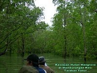
Mangrove forest and Amal Beach Tarakan City, Kumala Island in Tenggarong, and others. In east Kalimantan approximately 1000-189.000 plant species growing around such a black orchid price per flower can reach 100000-500000 But there are obstacles in the heading above places namely transportation. Many parts in this province still do not have asphalt roads, so many people travel by boat and aircraft and would not be surprised if in East Kalimantan has a lot of pioneering airports. In addition, there will be making plans Balikpapan-Samarinda Highway-Bontang-Sangata to accelerate the economy.

Derawan Island

Batu Lamampu Beach

Manggar Beach

Tanjung Jumlai Beach

Dayak Pampang Village

Mangrove Forest

Bekantan In Mangrove Forest

Amal Beach

Kumala Island

Selasa, 02 Maret 2010

Banjarbaru City


Located in south-east banjarmasin city has a museum containing objects peninggalanSuku Banjar and Dayak. The sculptures are derived from the Hindu Temple in Kalimantan are also available at this Mangkurat Gastric Museum. There is also a cannon, swords and other things remaining the war against the Dutch. Stomach Museum Collection is another kurat equipment such Banjar Traditional Circumcision and the leaf blade is used as the Antibiotic.

The museum is located in the stomach Mangkurat Banjarbaru City about 35 km from the city of Banjarmasin, storing various historical and cultural heritage as well as images from the face of South Kalimantan in various aspects of nature and natural potential.

The most interesting collection of the Museum is Gastric kurat objects excavation results from Hindu Temples such as the temple in Rantau Barrel and Temple Court in Amuntai. In East Kalimantan, including cow statue of Nandi and Symbol of genital god Shiva called Lingang. The remains found in the Temple Barrel Margasari village, near the town of Rantau, while the remnants of the Great Temple located at a distance Amuntai city 150 km from Banjarmasin.
The museum collection comprises items from the legacy of the Sultan of Banjar, archaeological objects from the Great Temple and the Temple Barrel, tools from Stone, Wood Carving Ulin, Agricultural Tools and Household Furniture, Traditional Musical Instruments and so on.

The museum building houses a combination of traditional modern style inaugurated in 1979.

Jumat, 26 Februari 2010

Derawan Island Resort


Derawan Island Resort has twenty traditional Kalimantan-style beachfront cottages with private bathrooms, terraces and air-conditioning or ceiling fans. The cottages accommodate up to forty divers or marine enthusiasts


The island is ringed by a white sand beach where thirty to seventy sea turtles nest nightly. Cottages sit back from the beach a bit to allow turtles personal space. Turtles lay eggs on the island, and you may witness hatchlings making it to the sea.Derawan Island Resort 1


Derawan Island is a divers` haven and offers many types of diving; walls, fringing reefs, caverns, and even a wonderful muck dive. You are likely to see big sea turtles, schooling barracudas, whitetip and leopard sharks, napoleon wrasses, cuttlefish, jacks and many many other creatures. There is a wonderful variety of hard coral around the island. Macro diving off the pier is world class, and you can find sea horses, scorpionfish, and other bizarre small marine animals.

Sangalaki


Sangalaki is truly a conservation island and as such all of the buildings at Sangalaki Dive Lodge are in keeping with this philosophy; simple and unobtrusive. 24 hour power is available on demand, but we prefer not to over-pollute the atmosphere with our generators unless specifically requested. Fresh water on the island is in limited supply. We will therefore ask for your understanding and consideration for water conservation. Less than 3% of Sangalaki Island has been built on, leaving the tropical rainforest to its’ natural inhabitants and visiting guests.

The dining hall houses the eating and relaxing areas, bar, sun terrace, dive boutique and TV/reading room. Our Chef is Angora, an Indonesian National who has extensive experience of working throughout Europe. His dishes can therefore be tailor-made to your personal taste buds! However, the meals are adequate and simple, so please don’t expect 5-star cuisine.

Scattered along the beach are 10 attractive individual sea view beach chalets. They are spacious and separated from each other by a comfortable distance for privacy. Each attractively decorated chalet is built on stilts about 3 ft. (1M) above the sand to allow passage for the turtles that nest on the beach every night. There are 4 ‘Euro’ chalets with air-conditioning and 6 ‘Borneo’ chalets with fan only, each with their own verandas, twin/double beds, and a private bathroom with hot water showers.

The island of Sangalaki and its’ surrounding reefs are protected as an Indonesian Marine Park. Without the destructive effects of explosives and cyanide fishing, Sangalaki has remained a pristine example of an untouched tropical marine ecosystem. In a world where every resort claims to be situated in a "diver’s paradise", Sangalaki truly deserves the honor.
Sangalaki is the prime nesting site for green sea turtles in South East Asia and home to exotic marine life that you've probably only seen in National Geographic. You'll see cuttlefish, blue ribbon eels, frogfish, turtles, manta rays, sharks, dozens of species of nudibranchs, hundreds of species of hard and soft corals, schools of brightly colored fusaliers and zillions of colorful reef fishes.

At the dive center there are rinse tanks for gear, one exclusively for Camera/Video equipment and an outside drying area.

Forest Pakis


In Singkawang, first of all I was treated to a local specialty that the Forest Pakis Cah. Forest ferns are very good, crisp like watercress stems, but not tough at all. Although only with herbs such as watercress cah usual, I could not resist the temptation to return to the buffet table and poured it into the vegetable back my plate. That said, Forest Ferns is taken directly from the woods and not cultivated. Anyone ever tried to grow but to no avail.
On the way Singkawang to Pontianak, my team invited to stop by to taste the foods of the area called Pengkang. Resemble lemper, but the triangular shape, is clamped by the bamboo and cooked by fire. Unlike the lemper, pengkang not have chicken in it but there are some ebi (small shrimp) are attached in the ketannya. It was real casual, I think even better lemper my brother made in Bandung:) But when you eat there, we offered to cocolannya sambal mussels.

Sentarum Lake National Park


This area is set for the first time as a Nature Reserve based on the Decree Appointment of the Director General of Forestry No. 2240/DJ/I/1981 date June 15, 1981 with an area of 80,000 ha, while according to the Minister of Agriculture Decree No. 757/Kpts-II/Um/10/1982 (Tata Guna Hutan Plan) dated October 12, 1982 with an area of 75,000 hectares, then the The same year (1982) complex is proposed to be Setarum Lakes Wildlife Reserve by the Sub-Balai KSDA West Kalimantan with 80,000 ha area.

In a further development based on the decision of the Minister of Forestry and Plantations No.. 34/Kpts-II/1999 dated 4 February 1999, the status of this area turned into a National Park with an area of Lake Sentarum approximately 132,000 ha.
• Location of the Regions
For Wildlife, is geographically located between 00 ° 45 '- 01 ° 02' N and 111 ° 57 '- 112 ° 20' E and the administration in the region Dati II Kabupaten Kapuas Hulu and included in the 5 (five) districts, the District Trunk LUPAR, Badau, SELIMBAU, SEMITAU and EMPANANG. The area is a collection of lakes and freshwater inundated forest is unique in its location in tersediri and inland up the river which is about 700 km from the mouth of the Kapuas River in Pontianak.

• Fisio-Ecological Conditions
According to Schmidt & Ferguson entered in the classification of climate types A and the value of Q = 9.75% and rainfall from 4000 to 4727 mm / year. The amount of rainfall is affecting the situation of the lake ecosystem, where field conditions are lowlands with hollows will be under water when the rainy season arrived with into between 6 - 14 m and a dry field when the season arrives.
Approximately nine months of the year, the lakes in this region almost always stagnant water and in July-August, a puddle of water on these lakes began to decline and then become dry land with only a small river that flows around the lake . This condition is normal cycles each year and greatly affect the lake ecosystem as a whole.
Lake Sentarum environmental conditions are extremely complex, with tidal fluctuations in the system which is very prominent, but affecting the entire ecosystem of the lake, also plays an important role as a buffer zone for the waters of the Kapuas River system, such as preventing the occurrence of floods and as a place to store water reserves so that when the dry season water level conditions in the Kapuas River stay awake.
Peat swamp forest area located in the vicinity of streams and lakes here are loaded with pickle and tannins with water hardness levels ranging from pH 4 to 5.5. Water conditions tend to be dark (blackish red brown), also causes the penetration of sunlight into the water is very low, so that the fertility rate or the nutrient content of these waters is very low.

Trench Mountain National Park


Trench Mountain National Park is one of nature conservation area which has a biodiversity of high-value, and various types of ecosystems including mangrove forests, swamp forests, peat swamp, freshwater swamp forests, tropical pamah forest, and jungle-covered mountains that always fog . Appointed Minister of Forestry, Decree No. 448/Kpts-II/1990 by 90,000 hectares area.
This national park is the only tropical forest area Dipterocarpus the best and largest in Borneo. Approximately 65 percent of the region, is still primary forest is not disturbed by human activities and have many plant communities and wildlife.
Like other areas of West Kalimantan, this area is generally covered by jelutung (Dyera costulata), ramin (Gonystylus bancanus), damar (Agathis borneensis), Pulai (Alstonia scholaris), Rengas (Gluta renghas), ironwood (Eusideroxylon zwageri), Bruguiera sp ., Lumnitzera sp., Rhizophora sp., Sonneratia sp., the strangler fig, and medicinal plants.
Unique plants belonging to this national park is the black orchid (Coelogyne pandurata), which is easily seen in the River Matan especially in February-April. The appeal of black orchid flowers appear on the form marked with green color combination with black spots on the center of the flower, and bloom time between 5-6 days.
There are 190 recorded bird species and 35 species of mammals that acts as pemencar plant seeds in the forest. All families of birds and probably of all bird species in Borneo, there are in the forest parks.
Animals often seen in Trench Mountain National Park of proboscis monkey (Nasalis larvatus), orangutan (Pongo satyrus), four-striped ground squirrel (Lariscus hosei), barking deer (Muntiacus muntjak pleiharicus), bear (Helarctos malayanus euryspilus), monkey (Macaca nemestrina nemestrina), klampiau (Hylobates muelleri), slow loris (Nyticebus coucang borneanus), rhinoceros hornbill (rhinoceros Buceros borneoensis), deer (Tragulus Napu borneanus), forest chicken (Gallus gallus), hornbills ivory (Rhinoplax vigil), Siamese crocodile (Crocodylus siamensis ), ivory turtle (Orlitia borneensis), and turtle urn (Caretta caretta). No less interesting presence of squirrels walnuts (Rheithrosciurus macrotis) are very rare, and difficult to see.

Tanjung Dato


is a cape with the longest beach in West Kalimantan, located in the Village Tamajo Kec. Paloh approximately 85 km away from the capital Kab. Sambas can be reached by motorcycle.

Monument Tours Pontianak


PONTIANAK - Supadio Airport Conditions considered less support efforts to develop the tourism sector in West Kalimantan. Because the existing facilities at the airport is very limited. According to DPD Chief Asita Kalbar Hefni when dialogue with Commission X group, yesterday. "The waiting room small plane and no longer suitable to the number of aircraft that come or go," he said.

If several aircraft leaving or arriving at the same time, the airport waiting room felt very cramped Supadio or solid. In addition, baggage service was also considered to be accelerated so that visitors do not have to wait long. Things like this thought quite influential in terms of service for tourists. Hefni hope airport conditions can be addressed. For that, the central government should intervene.

In addition to the airport conditions, problems Equator monument the iconic city of Pontianak was complain. According Hefni, Asita also often reaped criticism from various circles of Tugu Khatulistiwa.Tugu related conditions is necessary to set up and improved to better and more attractive to tourists. The problem, in addition to funding problems, efforts are also constrained the development of asset ownership. "It is our constraints in selling travel. Not to mention the problem of road infrastructure to tourist objects that have not been adequate," he said.

Chairman DPD PHRI Kalbar Edy Rashid also expressed similar things. According to Edy, soon to be held celebrations culmination point of the Sun at the Equator monument on March 23, 2009. This event assessed potential to attract tourists. Unfortunately, the condition of the monument is still alarming. "Part of land in that location is an asset that is where the Army's ammunition warehouse. Although warehousing activities are relatively inactive, but to liberate its land is still difficult," he said.

These problems have long experienced by the West Kalimantan. Governor of West Kalimantan has repeatedly changed. Pontianak Mayor also has several times changed but the issue remains unresolved. He hoped the Commission X can help fight the transfer of assets owned by the TNI to reform can be done maksimal.Ketua Commission X Irwan Prayitno said he would bring the aspirations that have been submitted to the central level. Aspiration is thought shows that there needs to be coordination across sectors and across departments in developing tourism, for example in airport improvements and the transfer of assets Equator monument. Related sectors are expected to be synergistic. (RNL)

PANCUR AJI "SANGGAU"


Aji Pancur tourist attraction is the tourist attraction to promote integrated natural beauty of tropical forests. Located very close to the city center Sanggau which is about 3 km from the city center. Only takes 10 minutes to come to these tourist attractions by car or water vehicles. There are many interesting tourist attractions such as water tejun, tengkawang garden plants, various animals, the beauty of tropical forests and many other interesting tourist facilities. The rushing river with many waterfalls is very interesting to visit as a tourist destination.
There are many small hills or "munguk" which beautify this area. We can see the city Sanggau dair hill. Aji shower is a natural museum and a place suitable for scientific research as well.

Surya Keraton State


Along with the development of human civilization, Sanggau cultural heritage also has the golden age of antiquity Sanggau community. This is indicated by the presence of Suryanegara Palace located in the town of Sanggau. Sanggau kingdom ruled in the 18th century with the title of king "Panembahan".
Historical records mention that the Government of the Kingdom of Sanggau first established by Daranante. He is not a native of Sanggau, but from Ketapang. Babai Daranante marry Cinga, ethnic Dayak from Sanggau. At first Sanggau Daranante palace built in the village rang, the Sekayam River upstream. But history does not mention what year the foundation. Then in 1826 the Sultan of Job as Panembahan Sanggau Kingdom at that time Sanggau Kingdom Center moved into the village and founded Sleep Jami '(located in downtown Sanggau now).

Ketapang


In recent years the attention of the district and city governments in West Kalimantan started to focus on the potential of tourism. Though already proclaimed long ago, but the new government's steps sounded serious repercussions.

One district that is intended to develop tourism Ketapang. Ketapang pontensi tourism has a prominent and diverse. One of them, nature tourism.

Superior natural tourism area Ketapang including mustard Beach Island. For those who wanted to be closer to nature, this place is perfect. Here, visitors can swim, boat, drink young coconut water, to fish with nets. If lazy to find yourself, there are fishermen who provide fish to be burned. Tourists can enjoy the fresh set of newly caught fish. They were treated to dinner with a natural landscape magnificent. Stretches of white sand, the water sparkling blue sea and coconut trees lined up in rows. Very natural that this island later known as Angel Island.

Another option for tourists lovers challenge. The destination location should Palong Mountain National Park. National Park is the extent of 90 thousand hectares. Position extending from Sub Sukadana and Simpang Hilir in North Kayong, and the District of North Lower Matan, Nanga TAYAP, and SANDAI in Ketapang. There are two uniqueness of Palong Mountain National Park.

First, in terms of fauna. In Palong Mountain National Park, until 2007, 2500 quiet tail of Utan, Proboscis Monkey, Honey Bear, and several types of snakes. Plus a variety of flora consists of tropical rain forests lowland forest, alluvial soil, peat swamp forests, swamp forests, mangrove forests, and vegetation rheofite.

Second, a challenging journey. To 'meet' with the fauna, rare fauna, tourists have to climb. The route is the village closest Segua with the distance of about 2 hours. Travelers will be taken to a camp called Lubuk Baji. Varied climbing terrain, sloping and steep. Because it requires a tourist guide. Guide that would help the tourists climbing the rope in steep areas.

Palong Mountain National Park has been proven to attract many foreign tourists. In addition, many studies are also held here.

Estuary Floating Market Traditional Market


Estuary Floating Market Traditional Market and Health is located on the Barito River at the mouth of the river and Health, Banjarmasin, South Kalimantan. The merchants and buyers use djoekoengs, as the boat in Banjar. This market began after the dawn prayer until after 07:00 o'clock in the morning. Sunrise reflective of the transaction and vegetables from the garden of the villages along the Barito river and its tributaries.
[edit] The atmosphere and the market activities
Floating Market painting by a painter

By witnessing a view, as if the tourists were sightseeing. Canoes laden with merchandise vegetables, fruits, all kinds of fish and other household needs is available in the market afloat. As the sun began to emerge the market gradually began to retreat, the merchants began to leave the floating market with the results obtained with satisfaction.

Floating market atmosphere that is unique and special are jostling between large and small boats to find each other buyers and sellers who are always milling around and always shaky play Barito river waves. Floating market does not have an organization like the market on the mainland, so not recorded how many traders and visitors, or distribution of merchandise bersarkan merchants.

Women traders who sell their products boating alone or neighbors called the hamlet, while the second hand from the hamlet of buying for resale panyambangan called. Keistemewaan market is still common barter transactions between the traders and boating, which in the language called Banjar bapanduk, something unique and rare.
[edit] Potential tourism

Sightseeing is often regarded as a fantastic attraction, Banjarmasin like Venice in the Eastern world, because they have the potential of river tourism. However different the two cities and natural cultural background. In Banjarmasin still mostly found along the river floating houses called lanting house, which is always shaky play wave.

Regional and Health is a type of settlement is along the river (waterfront village) which has several tourist attractions, either in the form of nature tourism, cultural tourism and cultural tourism. Lives of people living close to rivers such as the floating market, the riverside village with its traditional architecture. Lower mudiknya various traditional boats with various loads is an interesting attraction for tourists, even expected to be developed as tourist villages that could be forming the image in the promotion of tourism in South Kalimantan. Still in the same region tourists can also visit Tuan Guru Mosque and Masjid Tuan Guru, Kembang island, islands and island Bakut Surprise. In the craft and Health have also carved to ornament the house of Banjar.

Hapu Batu Caves


Hapu Batu Caves is a tourist attraction located near the market in the village of precisely Binuang Batu Hapu, sub Hatungun, which can be taken Tapin 43 Km from Kota Rantau and 154 km from Banjarmasin. Batu Cave Binuang Hapu of market entry as far as 16 km with a road that is good enough, followed by a leisurely stroll while enjoying the sights of rural life and the natural feel of the mountains for 30 minutes, this cave is situated so that the mountains had a hobby of rock climbing challenges here that nerve tested, but bear their own risk as they are not insured, the communities around the cave ready to partner with tourists who wish to spend the night while enjoying food and life of rural communities.

Batu Cave is a cave that Hapu has incredible panoramic view that has adorned the stalagnit and stalagmites in the caves that can inspire greatness of Almighty God in His creation as subjects of natural knowledge, this cave has a touch of repair and arrangement, local governments regarding damage caused by human elements of greed that only a moment of economic profit without the other grateful provided by nature.

According to legend who is now a local myth about the origin of the stone cave Raden Hapu Penganten is cursed by his mother, late Ingsun into stone and fragments of the ship into the mountains and caves that exist today.

Su'ada Mosque or Masjid Al ba'angkat


Su'ada Mosque or Masjid Al ba'angkat founded by Allama Sheikh H. Abbas and Sheikh Al Allama H.M. Said bin Al-Allamah Sheikh H. Sa'dudin on 28 Zulhijjah 1328 Hijri year 1908 along with AD is located in the village of Lower Wasah, Simpur, Upper South River a distance of ± 7 km from the city Kandangan. The mosque is built on the land owned by charitable Mirun Udin and Asmail bin Abdullah bin 1047.25 m² area.
[edit] Aristektur

Form the main building of the mosque su'ada square, three-story, has a goal to close the attic / puncah and petala / magnificent catastrophe. All that has particular significance as follows:

* The first level contains the meaning of Shari'a
* The second tier contains the meaning Tariqat
* The third level contains the meaning of Itself
* Attic meaning Ma'rifat
* Petala / magnificent catastrophe adorned with glittering branches of flowering and fruiting sdang symbolizes perfection Ma'rifat.

[edit] Events

Many events that happen as if a strange, irrational but real when will and mosques are under construction, such as a hurricane was blowing hard and exceptional rush that caused a huge tamarind tree was leaning at all would happen to the house [[| Sheikh HM Said | Al Allamah Shaykh H. M. Said]] (founder of the mosque Su'ada). Seen this scene, Al Allama was near the tree and pushed with the opposite direction, then with the help of Allah SWT powerful hurricane that turned the direction of the tamarind tree was uprooted and the selamatlah scholars.

Another incident which is one of the main pillars mosque about ± 10 cm long, so difficult for new building mosques. With the permission of Allah, the pole the next day becomes longer as needed. Other events, namely the middle way between Kalumpang and State, the group Al Allamah Shaykh H. M. Said running out of fish to eat, suddenly a big fish jumping into their boat and eventually they have fish to eat together. Another incident of the group at night in the boat could not sleep because kenyamukan, suddenly with the help of Allah SWT, the mosquitoes were gone, so the entourage of Sheikh Al Allama H. M. Said can sleep.

Now, Ba'angkat Mosque became one of cultural conservation and spiritual tourist attraction for local tourists.

Balangdaras Waterfall


Balangdaras waterfall is a waterfall located 25 km from City Pelaihari, Tanah Laut, South Kalimantan, precisely in the village of Tanjung, Pelaihari, Tanah Laut.

Balangdaras waterfall has a beautiful panorama of mountains and exotic. At an altitude mountains with altitude ± 45 feet. Balangdaras Waterfall located in the Meratus Mountains.

Rabu, 24 Februari 2010

Garuda Wisnu Kencana


Garuda Wisnu Kencana (GWK) Cultural Park is a tourist park in Jimbaran Bali with Unggasan tourist GWK Statue (Garuda Wisnu Kencana). GWK statue is a replica statue of the god Vishnu riding Garuda vehicle named 12 m tall, the work of renowned sculptor Bali, I Nyoman Nuarta. Area Cultural Park Garuda Wisnu Kencana in the height of 146 meters above ground level or 263 feet above sea level.

This statue is projected to bind to the spatial distance of up to 20 km that can be seen from Kuta, Sanur, Nusa Dua to Tanah Lot. Garuda Wisnu Kencana statue is a symbol of environmental rescue mission and the world. This statue is made from a mixture of copper and steel, weighing 4000 tons, with a height of 75 meters and 60 meters wide. When construction is finished, this sculpture will be the largest statue in the world and beat the Statue of Liberty.

Kalangayar


In the mountains around Kintamani, there is Mount Batur with a deep crater lake and the natural hot springs in Toyabungkah. The cool mountain air with views in all directions, as beautiful with the existence of several important temples, which have made Kintamani become one of the places that do not forgotten the Bali tourist agenda.

Mount Batur is one of a small volcano, but its location was in the midst of a large crater diameter of 14 Km. In addition, Mount Batur Lake Batur adjacent to the crescent-shaped high wall surrounded the outskirts of the crater. The size of the crater steepness will make you imagine the massive eruption of Mount Batur which happened ten thousand years ago.

Mount Batur Kintamani BaliGunung is still active today as Balinese people who still remember the explosion that occurred in the 1917 eruption which has taken thousands of lives and destroyed hundreds of houses Old Batur village at the bottom of Batur caldera. Selajutnya society still alive finally fled to the village of Batur is now (Kalangayar, which means a new place.) Pura Batur Ulundanu previously also at the bottom of the caldera in the south part of Mount Batur which was moved into place now.

Enchantment here offered more to the tourism landscape. Landscapes are a combination view of Lake Batur and Mount Batur which stands in the middle of the caldera make this area one of the most favorite tourist destination in Bali

If you have more time and like adventure or photography, it helps you stay in the area around Mount Batur to make the climb and then the next day or the caldera of Mount Batur Batur to the east of Mount Batur while enjoying the beautiful sunrise coming out from behind Mount Rinjani in Lombok.

Kintamani tourism object can be achieved approximately 2 hours drive from Denpasar or Kuta. You can also pass when you inging trip to Lovina.